
| Wednesday 20th August 2008 |
| Cambridge Bay, Nunavut, Canada |
When we last updated you Maeva had just arrived and we were waiting on a good ice report before setting out to cross Baffin Bay to get into the Northwest Passage proper, well I am happy to report that we are now right in the middle! Tonight we are tied up alongside the wharf at Cambridge Bay – about half way through. We left Upernavik in light winds, taking the inshore route for the first half of the day which saw us pass through Upernaviks Isfjord, I thought it would be good if Maeva cut her teeth with bit of ice navigation on the first day. Wasn’t quite expecting 4 and 5 tenths but the glacier was pumping out quite a bit of ice, so we spent the morning dodging and weaving through areas with bands of as much as 4 tenths of ice and in the end this became too thick and we headed further offshore to get in to easier sailing conditions. It was a great introduction to sailing (motoring, the wind dropped out to nothing) in Greenland for Maeva. The fjord was glassy calm, big bergs were melting and cracking and every now and then there would be a rumble like thunder as a big berg would calve or roll over. |
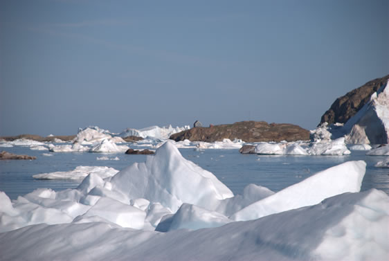 |
Upernaviks Isfjord |
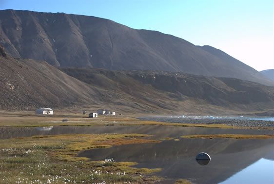
Our plan for the day was to get to Kraulshavn, a small settlement of about 300 people and a traditional Greenlandic hunting community. We arrived at 11:30 pm and anchored about 10 metres from the shore with our stern tied off to a rock, 30 feet of water under the bow, 8 feet under the stern and 25 sled dogs watching over us on the hill above.
|
|
|
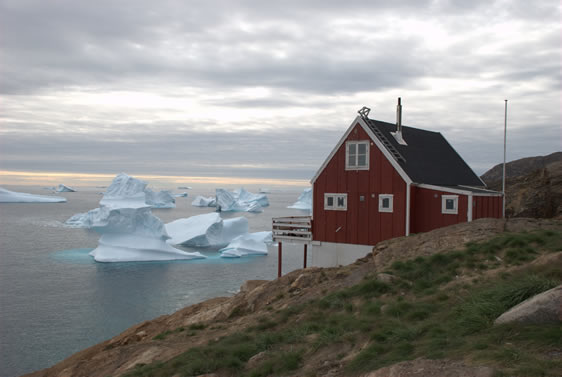
Kraulshavn Anchorage and Village House |
The ice report from the doctors office was good, so after a day of exploring downtown, Maeva picking blue berries and me climbing the peaks around the village on the morning of the 1st August at 9 am with a following breeze of 20 knots we set full sail for the north edge of middle pack at 75 degrees north. |
|
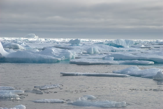
The Middle Pack |
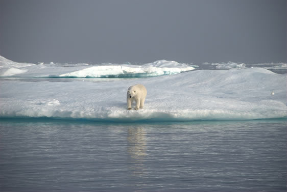
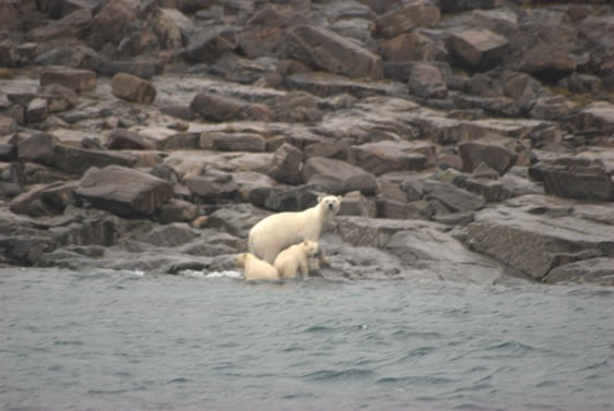
We now set course direct for Cape Shepard on the north shore of Lancaster Sound. We thought that we had seen the last of the pack ice in Baffin Bay but at about midday on the 3rd of August we were back in it again with absolutely calm conditions and fog banks. Maeva was saying how beautiful it was and we decided to get the video camera out – as I started to motor over closer, I noticed that there were a blob of cream coloured ice on top of one of the flows, a polar bear!! |
|
Icebear |
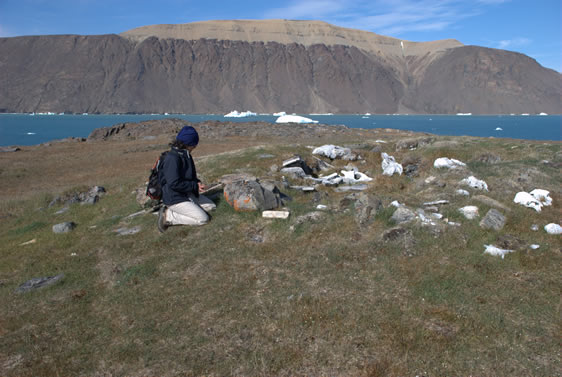
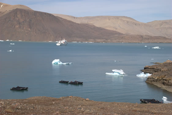
We motored on through absolute still conditions for the next 36 hours, arriving at the entrance to Lancaster Sound at 3 pm on 4th of August, the forecast for the east end of Lancaster was for 15 knot easterlies increasing to 30 knots. We headed for Dundas Harbour on Devon Island as the wind built up to its forecast high. 10 pm anchored, calm waters, glacier at the head of the bay, a few small bergs and muskox and snow geese on shore, bed then exploring in the morning. We woke to the ticking sound of a ships propeller – a cruise ship was entering the inlet! Before we had had breakfast, black inflatables were in the water, crew put ashore who were shooing the Muskox off the point. This done 10 more inflatables loaded up about 90 passengers and off they went to look at the abandoned RCMP outpost and to climb the point. We were able to beat the passengers ashore and had a look through the RCMP post, climbed a few low hill, then walked over to the point where we found the remnants of a Dorset culture settlement (pre 900 AD); rings of stones for holding down skin tents which these hunters used in summer and remains of sod huds which were their winter dwelling. These early inhabitants of the arctic hunted whale from small seal skin boats, remants of their catch still in evidence around the site. |
|
Abandoned RCMP Outpost - Dundas Harbour |
|
Maeva inspects remains of Dorset sod hut |
|
Cruise ship and inflatables |
We stuck our nose out into Lancaster again at midday on Wednesday August 6th as the wind seemed to be abating – how wrong I was! As we got further out into Lancaster the wind and seas picked up, soon we had 35 knot plus easterlies and then later in the day 40 knots, following seas of about 4 metres with some larger sets every 20 minutes or so. We were sailing dead down wind so were rolling from side to side, Maeva was unwell and steering was a real chore! On the bright side, the sun was shining and going downwind meant we were not taking any water over the deck so I was dry, but getting tired after 8 hours of hand steering. (Jim our autopilot stopped working as we reached Lancaster due to our proximity to the magnetic north pole.) Cuming inlet was close and so we headed for shelter, at 10pm we were a mile inside the inlet and had relatively flat water – my evening radio sched told me that the forecast for Lancaster had been revised to Gale conditions for the next 2 days. So we motored about 8 miles up the fjord and found a protected anchorage off a low point in about 20 feet of water, the mountains of Devon Island all around us. As far as spectacular anchorages go this was probably a 9 out of 10. |
|
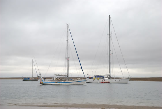
Anchorage in Cuming Inlet - Tyhina bottom right hand side. |
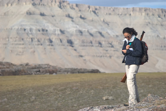
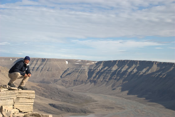
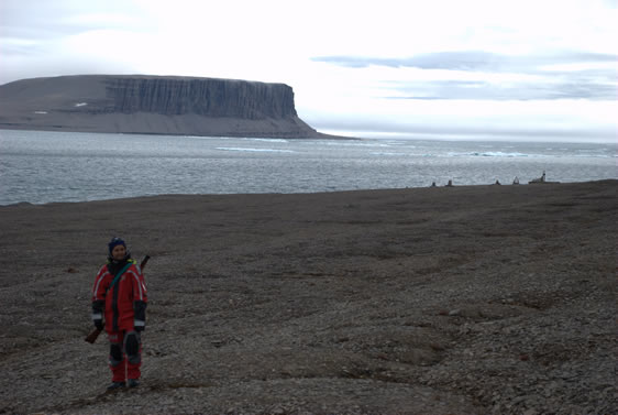
We stayed here for the next two days climbing to the top of the cliffs and generally exploring ashore, although we did not see any, polar bears are common on Devon Island and so all of our trips ashore we took the rifle for protection. |
|
Maeva with her constant companion while ashore Lee Enfield |
|
A short climb to get the blood flowing. |
|
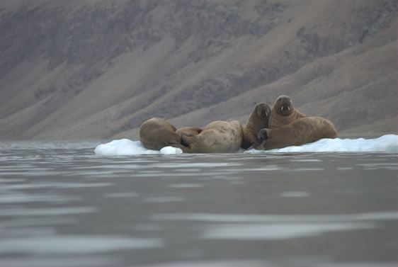
Sneaking up on walrus |
After the gale conditions had passed we headed for Beechy Island, where the Franklin expedition wintered in 1846. As we left Cuming inlet we spotted another sail boat up ahead coming out of the next inlet. It was Baloum Gwen a 47 foot French cutter that we had met in Upernavik, and also doing the NWP. An hour later we had caught up to them after calling them on the VHF. They were headed for Resolute. We sailed along together through the afternoon and then into the night. |
|
Ashore on Beechy Island - cairns and graves in background |
We departed Beechy at 2pm and headed for Resolute, another 40 miles west arriving there at 10 pm that Saturday evening. Thierry the skipper of Baloum Gwen had us aboard for dinner at midnight then we all turned in for some well earned sleep and a Sunday morning sleep in. We had to clear customs at the RCMP on Monday morning, so 10th of August was a rest day. We met Aziz who owns one of the local hotels, he invited us to come and have soup, coffee and a shower at his hotel. Aziz also let us use the internet at the hotel, arranged our fuel and showed us some places to anchor in Peel Sound which we were very grateful. Monday 11th August – arrived at the RCMP office at 9am hoping to clear customs within an hour. It turned out to be a longer process than expected as all of our info had to be faxed to the nearest Customs and Border Protection Office which was in Iqaluit. As we had not phoned ahead to advise that we were going to be arriving in the northern arctic there was quite a bit of paperwork to do. (Skippers reading this – phone ahead and get your CANPASS 1-888-226-7277). We cleared customs at about 4 pm and were on our way. Passports stamped and fueled up we departed Resolute for Peel Sound and more ice – this was to be the most critical leg of our journey so far. As we left Resolute the southern end of Peel Sound was still jammed with ice, we intended to make our way slowly south and wait it out at anchor until the ice was passable. Peel Sound gave us a wildlife feast – on our first full day in Peel (Tuesday 12th August) we sailed past 4 polar bears on the shore; one solitary male and then late in the day a mother and 2 cubs. We anchored at just south of 73 degrees north at Four Rivers Bay and spend Tuesday night. |
|
Mother and cubs in Peel Sound |
Snow Wednesday morning! We spent the day ashore. That evening we were expecting to have to spend a few more days in Peel Sound, but the ice report informed us of a possible lead opening up at the south end, we were on our way. At 9:30 pm we weighed anchor and headed south, the hills around us now covered in a light layer of snow – definitely time to get going, summer does not last long in the arctic. Overnight we made good progress and were abeam Cape Eyre at 7:30 am Thursday morning during the night we had sailed with pods of Narwhals, Belugas and large groups of seals, an amazing night. The weather was sunny and the breeze was about 10 knots we set full sail and actually sailed through the ice flow, Maeva at the helm and I was up and down the mast to find the leads and the best routes through the flows. |
|
Sailing through the ice |
|
|
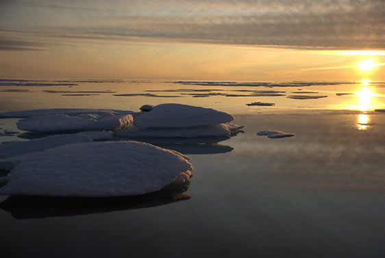
First Sunset in 2 months |
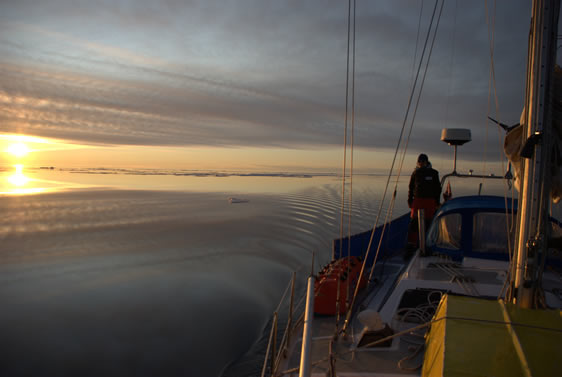
Maeva took the first night watch and allowed me to sleep through the night. At 3am I came back on deck just before sunrise. At 4 am I spotted a yacht ahead, picking its way through the ice toward us. This was Amaldino a 75 foot Spanish motorsailer, we made contact over the radio and rendezvoused. With Tyhina tied alongside I went aboard for a quick coffee and a chat. Amaldinio was heading east to Greenland and then Europe. We wished each other fair winds and following seas, light flows and temps above zero. Motoring then motor sailing we continued toward James Ross Strait through the day arriving with a bang at Victoria Point at 2:30 pm on Friday 15th August. The bang was a very well marked shoal on the chart, but as usual I was cutting things a bit fine and we touched bottom a couple times, even with the centre board up. We sailed down James Ross Strait, into Rae Strait and Rasmussen Basin that evening with a fresh 20 knot breeze on our starboard quarter by daybreak we could see the DEW station at Gjoa Haven ( a cold war relic??) That night we drank a toast to Amundsen aboard Southern Star with the crews of Baloum Gwen and Arctic Wanderer after all it was due to Amundsen’s stay at the same anchorage in 1904-5 in his boat Gjoa that Gjoa Haven exists. |
|
Tyhina, Baloum Gwen and Southern Star at Gjoa Haven |
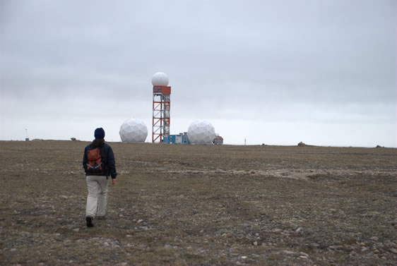
We spent Sunday walking around Gjoa Haven and also walking over to the DEW station (Distance Early Warning) these were built in the 50’s to detect missiles that may have been launched from the Soviet Union. They are still operating today, I guess there are still a few nuclear missiles floating around the former USSR so you never now. |
|
Dew Station - Gjoa Haven |
|
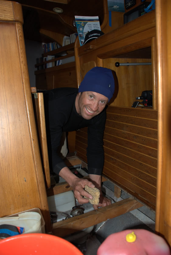
When I'm not taking photos |
Departed Gjoa Haven at 7am Monday morning in light snow, winter close on our heals, the flurries cleared to blue skies and nil wind later in the morning and we made our way through the narrows of Simpson Strait. The narrow channel between these low islands is marked with lead lines, it was on the first of these that I noticed that the chart plotter was showing our track ½ a mile to the north east of our actual position something to be aware of as we continue west. We followed the leads through the narrows and emerged on west side late in the after noon and set course across Queen Maud gulf for Cambridge Bay via Requisite Channel to avoid that reefs and islands about half way across. The wind was forecast to fill in from the north east and build to 20 knots it did this and a bit more. Two reefs in the main and a bit of headsail and we were making 7 and 8 knots with the occasion 9 on a beam reach as the wind went more northerly. During the previous evening Jim had regained his composure and was now doing all the steering again. Hopefully he will continue to work as we have hand steered for more than 650 miles. The wind decreased to about 15 knots late in the afternoon then went westerly and we punched into this all night however at 5 am on the 20th we rounded Cape Colborne cracked sheets and sailed into Cambridge Bay, Tyhina safely tied up at the dock by 7:30am. So from here its only the Beaufort Sea, Arctic Ocean, Bering Strait and Sea then were into the Pacific. Still a bit to go yet. |